
Welcome to the OGC Newsroom
You’ll find the latest announcements from OGC here.
Never miss an update! Subscribe to our bi-weekly newsletter for the latest news and events delivered right to your inbox.
News
Cassie Lee Joins OGC as Chief Innovation Officer
As OGC’s Chief Innovation Officer, Cassie Lee will leverage her expertise in aerospace, emerging technology, and AI to drive innovation and expand the Consortium’s impact.

Enhancing Security and Efficiency in Cross-Border Infrastructure with OGC Standards
Critical infrastructure faces growing security risks. OGC standards enable interoperability, real-time monitoring, and risk management for underground cables and power lines. Join our Testbed initiative…
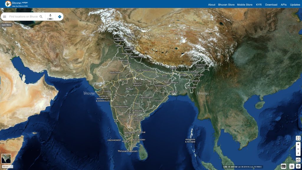
Bhuvan: Transforming India’s Governance with Geospatial Insights
The Bhuvan portal, developed by the Indian Space Research Organization’s National Remote Sensing Centre, is powered by OGC Standards and caters to 150,000 unique users…
Calls and Requests
OGC members can submit proposals for COSI Initiatives when a Call for Participation (CFP) or Sponsorship (CFS) is released. Members of the public are also invited to provide feedback on standards, charters, and other consensus-based activities.
OGC looks to adopt openEO as Community Standard; Seeking Public Comment before moving to vote
OGC seeks public comment on adopting openEO API & Processes as Community Standards to unify cloud-based Earth observation data processing. Comments due April 21, 2025.

OGC looks to adopt STAC as Community Standard; Seeking Public Comment before moving to vote
The STAC family of specifications aim to standardize the way geospatial asset metadata is structured and queried.

Public Comment Requested on v2.0 of OGC Geospatial User Feedback Standard
OGC seeks public comment on the Geospatial User Feedback Standard v2.0, which enhances geospatial metadata with user insights. Comments due by April 21, 2025.